We were sailing south about 15 miles off the California coast when we saw a huge group of sea lions splashing in unison in front of us… there must’ve been over a hundred. It appeared they were herding some sort of bait fish. We slowed the boat to watch. We didn’t need to move closer as the whole group shifted and swam toward us. It was a phenomenal sight, a sea lion feeding frenzy — then suddenly, several whales surfaced in the middle of the melee. We watched, transfixed, as the sea lions and whales broke up the bait ball, herded it back together, and feasted over and over again. Another amazing day as we explore the world on our sailboat, Gadabout.


Be sure to check out the video, too!
Those who know us well know that we’re fairly social people. They also know, though, that we don’t seek out large group social activities and we typically like to do things on our own program. For instance, when we wanted to snorkel with the manta rays in Hawaii, did we sign up for a tour with its easy transportation and group fun? No. We took our own snorkel gear, rented a dive buoy and light, and slipped into the dark depths of the ocean to swim around a point at night for our own adventure. And it was awesome (except for nearly being dashed on the rocks and the slight sea sickness due to the rough water). For our first foray into Mexico via sailboat, however, we decided to sign up for the annual Baja Ha-Ha rally and make the trip from San Diego to Cabo San Lucas with 530 of our closest friends (or rather, strangers).
Leaving San Diego harbor with 135 other boats was a sight to behold. As darkness fell that first night, it was a surprising sight, in fact. Most offshore overnight passages produce very few encounters with other boats. Our busiest to date had been in Oregon when we saw about 10 fishing boats throughout the night, but that was nothing compared to the number around us on the first Ha-Ha leg. Night watch required constant vigilance to avoid too close passes or worse, collisions. By the second day boats had dispersed enough that these close calls were less of a concern. The benign weather of past Ha-Ha rallies refused to appear, however, and any hope of a relaxing passage disappeared in 25-knot winds and 10-15 foot seas, making for a very uncomfortable ride and a diet of pretzels and water. Day three brought a reprieve from the rough seas in the lee of Isla Cedros before we headed through Dewey channel to round the point toward Bahia de Tortugas (Turtle Bay), the first official anchorage of the rally. Making good time and with only an hour more to go, Wags saw a flash of light and we heard the distress signal from a fellow rally boat that had run aground very near our position. Our “one more hour” became four hours as we diverted to assist with the search and rescue effort (see “Disaster!”). We finally dropped the hook in Turtle Bay and settled down in the cabin with a drink and dinner in the wee hours of the morning, thankful to have the first leg behind us and a couple of relaxing days ahead.
With the Ha-Ha fleet present, Turtle Bay was abuzz with activity. The normally tiny town with dirt streets and only a few fishing pangas in the harbor was transformed into a bustling scene: over 100 anchored boats dotted the bay; Ha-Ha participants visited each other via dinghy; pangas in their temporary roles as water taxis screamed past carrying passengers to and from the beach. In town the few restaurants were full of people eager for cervezas, tacos and wi-fi. As we wandered the streets to get a feel for the town, the elementary school let out and several children took the opportunity to practice their English with the gringos, one little boy asking if we were going to the baseball game later that afternoon. “Si!” we replied. Turtle Bay, thanks to a wealthy benefactor, has a first rate baseball field, complete with artificial turf and grandstands. Each year, the Ha-Ha rally hosts a just-for-fun baseball game. There are no teams, no score, just the requisite people covering bases and the outfield – several decide only at the last moment whether to put down their beers to shag a fly – and a LONG line of batters made up of rally participants and local residents. In the stands, people cheer on the spectacle, reserving their loudest cheers for the local kids, some of whom are, no doubt, the best players on the field. An all-day beach party and picnic the following day gave us a great chance to get to know some of our fellow cruisers.


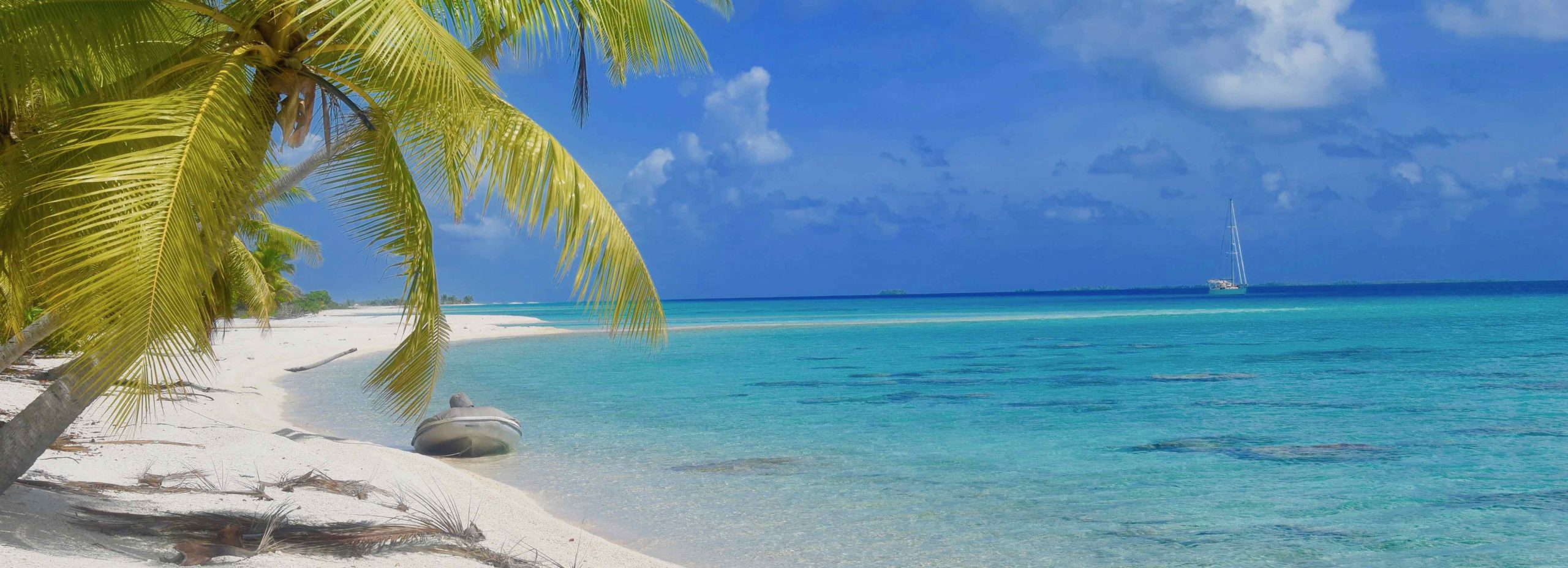
Leaving Turtle Bay, we continued south for two more days to Bahia de Santa Maria. Perfect conditions on day one yielded great sailing and our first fresh fish dinner. Lack of wind on day two forced us to motor, but the calm seas were still a welcome change from the first leg. Bahia de Santa Maria is a beautiful, remote bay. There is no town, only a smattering of small shacks used by the fishermen during the season. We spent two days there, working on our tans, doing a few boat projects and socializing – a dinghy raft-up/impromptu jam session the first night and a beach party with a live band (that traveled 12 hours to get there) the second night. The best part of Bahia de Santa Maria, though, was the surf break. The waves weren’t big but they were fun, and we were the only surfers on them.


One more overnight brought us to Cabo San Lucas. We continued on for another 20 miles to Puerto los Cabos in San Jose del Cabo, a much quieter and more laid-back atmosphere than the late night party scene and rolling anchorage of Cabo. (Based on feedback from other cruisers we made the right decision.) Transportation was a challenge being so far from the immigration office and rally activities, but we quickly remedied that with a rental car. The Ha-Ha rally officially ended with two more parties and an awards ceremony.


Following the rally wrap-up, most boats immediately headed to the Sea of Cortez. We opted to hang back for another week. We were in no rush and wanted to take a little extra time to enjoy the area before moving on (and to allow Wags to recover from the first food-borne illness of the trip). One day we strapped our surfboards to the top of the car and headed north. An hour and a half later, with bellies full of scrumptious shrimp tacos at non-Cabo prices, we bounced down a mile-long, rutted dirt road to Punta Pescadero and spent the afternoon surfing. Afterward, we headed to Todos Santos, one of our favorite Mexican towns, for a post-surf cerveza and snack before returning to the boat.


Traveling as part of the rally had its positives, including learning from the challenges faced by 135 other boats and the opportunity to meet a lot of great people we’ll cross paths with again in the future. After 10 days of crowded anchorages and large group fun, though, our social meter was pegged at overload. We were ready to get back to our own, fairly social, program.
It was a pitch-black night after three very rough days of being offshore. We were nearing our harbor and being very careful to ensure we gave the entrance point plenty of clearance. Normally we try to avoid entering unknown harbors at night, but the entrance was straightforward and half the Baja Ha-Ha boats were already there providing a good idea of where to anchor. Suddenly a loud alarm started blaring and a red light flashed to my port. I immediately turned away from the land/light while Paula went down to check on where the alarm was coming from. My initial thoughts were that someone was trying to warn us of a hazard, and it was quite unnerving in the inky blackness to not understand what was going on. P silenced the alarm—it was a distress signal coming from the VHF radio. Whew! At least we knew it wasn’t something we had triggered. The alarm blared again, this time with a “Mayday” call. It was garbled, but something about “we’ve gone aground.” Then, silence.
The distress signal automatically transmitted coordinates so we were able to plot it and see that the signal had, in fact, originated where I saw the red flash, probably a flare. The radio was filled with chatter with the rest of the fleet trying to make sense of what was showing up on their systems. Since we were closest to the transmitted coordinates, we became the de facto “on scene commander” and headed toward the location. For the next several hours we circled off shore scanning the darkness for indications of signal lights, wreckage or survivors in the water, relaying radio transmissions and being careful not to put ourselves in the same predicament—the first rule of a SAR (search and rescue) is don’t become a SAR yourself. Another boat that was assisting was able to go closer to shore where a fisherman came out to meet him. There was a language barrier but the crew was able to determine that an American sailboat had run aground and that the passengers were now on shore and being attended to by the Mexican Policia. We stayed on station a while longer until we were able to verify that all occupants were safe and accounted for, then resumed our pitch-black harbor entrance; it was now one thirty in the morning.
The next day we were able to piece together some of what had happened. The boat that went aground was a US sailboat (SV Summerwind, a Newport 41) and part of our rally. There had been three people aboard, the 58-year-old owner, his 22-year-old son and a 75-year-old crewman. No one was injured, but the boat was a total loss. Initial reports indicated that they had tried to navigate by the wrong scale of chart. This has not been corroborated but based on the benign conditions at the time (other than darkness) and the fact that no mechanical difficulties had been reported, it likely was human error. It was a late night after several very rough days so fatigue may have been a causal factor. Paula and I were certainly knackered when we finally dropped anchor. I’m sure it was a devastating blow to the owner and his crew, but on the positive side, no one was injured. Boats can be replaced, but people can’t.
— Wags

San Francisco: A week in San Francisco Bay is never enough to see and do everything but we were able to explore some areas we hadn’t seen in previous visits – Sausalito, Angel Island, Berkeley and Emeryville. The annual Fleet Week was in full swing, too, so we caught a Blue Angels show, which is always a treat.
Leaving San Francisco, we hopped down the coast, stopping at several more northern CA ports along the way –
Half Moon Bay, home of the famous Mavericks surf break;
Monterey, where the sea lions rule the roost;
Morro Bay (one of our favorite coastal towns), where we caught up with new friends, Carl & Bebot, whom we met in Brookings, OR.


From Morro Bay, we did an overnight and rounded Point Conception, our last major West coast navigational challenge, at night. We were lucky to have light winds and calm seas the entire time.
Santa Barbara: We pulled into Santa Barbara in the early morning and settled into our first southern CA port. We spent four days there, taking in the Harbor Festival, marveling at the beautiful Spanish architecture throughout town, and filling our bellies with good food before continuing south.
LA: After a full day of motoring (thanks to more low/no wind conditions), we grabbed a slip in the beautiful setting of the Marina Del Rey Marina and watched the weekly sailboat race in the channel. With only a couple of days in town we hit the ground running the next day, hoofing it to Venice Beach to check out the famous boardwalk and returning on our newly procured skateboards, a slightly faster but less stable (for Paula, at least) mode of transportation. The next day, we rented a car and explored further afield – Santa Monica, Beverly Hills, Hollywood Blvd., Sunset Blvd., and Burbank, plus a visit to the Griffith Observatory and an obligatory pic of the Hollywood sign. Our only rule when driving in LA was “NO HIGHWAYS,” so our route back was an interesting tour of business districts and neighborhoods, some grungy and others over the top swanky. We had a fun time but two days was enough – time to leave the city in our rearview mirror.


Catalina Island: Several people had told us how beautiful the Channel Islands are and that we absolutely must visit, especially Catalina. We nearly skipped it because we only had a day to spare and there were other coastal ports we wanted to visit. With such strong advice, though, we figured we should give it a go. When we moored at Isthmus Cove in Two Harbors, we saw a barren and dusty landscape and a harbor full of mooring balls filling up quickly with weekenders from LA, not exactly the serene beauty we had hoped to find. What we experienced over the course of a day, however, was a laid-back, festive atmosphere with tons of activity – kayaking, paddleboarding, snorkeling – and water so clear you don’t even need to touch it to see the sea life fifteen feet below the surface. We took a few hours to check out Avalon, as well, which has a much different feel, with a busy harbor, a bustling tourist town full of boutique shops and restaurants, and the Casino (not a gambling establishment, but rather, a large event center and theater).


San Diego: One overnight from Catalina Island put us in San Diego, where we’ve spent the last week doing all the last minute preparations before we leave the US and head into Mexican waters. It’s not been all work… we’ve also had the chance to visit some of our fave locations and catch up with old friends, the best way to finish our trip down the US West coast.


On Halloween morning, we departed for Mexico as part of the annual Baha Ha-Ha cruisers’ rally from San Diego to Cabo San Lucas (www.baja-haha.com). Be sure to follow along on our international adventure!


After five weeks at home visiting friends and working on boat projects we put Anacortes in our rearview mirror on Sep 12th and headed to Neah Bay, WA, the stepping off point for our trip down the west coast. Our plan was to take advantage of a short but good weather window that would allow us to go 30-40 miles offshore and sail directly to San Francisco, taking about 5 days. Best laid plans…
After two days we were making good time, albeit with the motor assisting the sails due to a lack of wind. We had settled into our 3 hours on / 3 hours off nighttime watch schedule. On the third day the wind finally picked up, as did the seas, and we shut off the motor. Unfortunately, shortly after, our autopilot seized up and we were forced to hand steer, which is akin to driving a semi truck without power steering. In calm conditions this wouldn’t have been a big deal, but with strong winds and heavy seas it was a very uncomfortable and physically taxing situation. We certainly didn’t want to deal with it for another three days to San Francisco so we headed to the nearest harbor, Brookings Harbor, OR – which wasn’t all that near – about 30 miles (or 6 hours) away.
A week later, with a freshly repaired autopilot, we motored (still no wind) down the coast to Eureka, CA, where Wags polished off a few more boat projects while Paula jumped ship for a short trip to Ohio to attend her high school class reunion and visit with family.
When we finally passed under the Golden Gate Bridge into San Francisco Bay, a quick calculation showed that our 5-day passage from Neah Bay had taken 17 days. Yes, it took longer than planned, but we faced new challenges, saw new places and met new people along the way, all the elements of a good adventure!


The rest of our trip down the west coast of Vancouver Island was a mix of secluded anchorages, quaint towns and new friends. The Bunsby Islands, Dixie Cove, Young Bay and Barkley Sound provided our last few bits of isolation. Winter Harbor, Walters Cove and Zeballos gave us a chance to stretch our legs, chat with the locals and make some new friends – after meeting the three amigos on M/V Carisma, they were a common sight at several of our anchorages down the coast. Tofino was a great blend of surf town culture with a bit of cosmopolitan thrown in, mainly by way of cuisine and brew. Our last night was spent in Oak Bay at a popular marina in a relaxed suburb on the east side of Victoria, BC. The next day, as we rounded the corner of San Juan Island toward our Customs clearance in Friday Harbor, we felt a good dose of culture shock seeing the sheer number of boats in the area. After a quick check-in we motored through the islands, crossed Rosario Strait, passed under Deception Pass bridge, and grabbed the mooring ball directly in front of our house. We were home… for now.
We found that one of the first questions people ask since we returned is, “What did you learn?” So, here’s what we learned, in a nutshell, in no particular order:
- SE Alaska is amazing and absolutely exceeded our expectations.
- Wags’ interpretation of comfortable wave height was somewhat skewed by 24 years in the Navy and many days at sea on ships much bigger than 48 feet. Ten-foot seas on an aircraft carrier are NOT the same as on Gadabout. His meter has been recalibrated.
- Capes are the real deal (see “Respect the Capes”). We will experience many more in the years to come; now we know what to expect.
- The life expectancy of electric pumps is approx. 8 years (We replaced three on this trip).
- Any docking you walk away from with no new scratches on the boat is a good one.
- Rafting to other boats is NOT a good idea in a strong current, although our de-rafting “challenge” gave us a good excuse to buy a new grill.
- Surfing tidal rapids is one of the coolest things ever (see “Surfing in Alaska”).
- Paula needs a bigger lens.
- Gadabout has a mind of her own when going in reverse. And when swinging at anchor. Our new mantra: “Gaddy gonna do what Gaddy gonna do.”
- We never get tired of seeing whales. Or bears. Or otters. Or pretty much any wildlife. (Horseflies and mosquitos do not count.)
- Our depth finder is schizophrenic. At one point, our 6-ft keel should’ve been 3 feet in the mud according to its reading.
- New experiences are made even better when shared with friends. This is one we already knew but it’s worth repeating. We look forward to sharing more of our sailing adventures with friends along the way.
- We swore we’d never navigate by a cartoon map. This typically applies to tourist maps (i.e., don’t walk toward the big cartoon beaver to find the river). Now we do it on a regular basis – our electronic charts are a significant aid in our navigation. That said, if you unexpectedly see the bottom, STOP.
- We are thrilled with Gadabout’s seaworthiness and level of comfort, and we are ready to take her around the world.
- We can spend at least 89 days together and still be ready to continue the adventure.
We probably learned more lessons but in the interest of not revealing the most embarrassing ones and not boring our readers, we’ll stop here.
Stay tuned… the adventure continues in September when we head south toward Mexico.

Swells lifted Gadabout’s bow and drove it into the next wave, over and over, sending rushes of salt water onto the deck and down the gunnels. We held on for the ride, watching the foredeck intently, hoping the tie-downs on the gas cans and kayaks were secure enough and wishing we had remembered to put an extra tie on the anchor…
Two days earlier our southward crossing of Queen Charlotte Sound was only slightly uncomfortable with a few rolling swells on our beam, quite calm in comparison to our journey north back in May when the ship’s log at the end of the day read, “One crew lost to sea sickness.” Based on these conditions and the most recent weather forecast, we decided to revise our route and return home via the west coast of Vancouver Island. We headed to an anchorage on the north side of the island to set ourselves up for an early morning departure the next day to round Cape Scott. Unlike the east coast of Vancouver Island, which is well protected with comparatively benign conditions, the west coast is more rugged and wild, requiring careful planning and attention to weather, especially when preparing to tackle the two substantial capes, Cape Scott and Cape Cook, and open ocean waters in the northern section. The waters around a cape can be very confused, waves coming from every direction, ocean swells from multiple angles competing with wind and current. Periods of accelerated winds and heavy seas can create treacherous conditions.
We had checked windyty.com, our go-to app for a consolidated wind forecast, a couple of days earlier when we had internet connectivity. The night before and the morning of our start, we listened to the marine weather conditions reported by the Canadian Coast Guard on the VHF radio. We were happy to hear a forecast of 10 kt winds and 3-4 ft seas off Cape Scott.
We weighed anchor at 0600 and headed out. It would take two hours to reach the cape and we wanted to make sure we rounded it in the morning as winds tend to pick up significantly in the afternoon. Aside from a gentle ocean swell it was an easy couple of hours. We were making great time with an ebb current; enough, in fact, to slow down briefly when a humpback whale put on a tail-slapping show less than a hundred yards away. As we continued on and reached Cape Scott, however, the wind and wave heights started to increase steadily and substantially. The water off the cape on this day was the picture of confused. By the time we turned south, we were seeing 20-25 kt winds and 6-9 foot seas, and taking it from every side. It was rough, much rougher than we expected given the forecast. Had we known, we probably would’ve waited a day, but now we were in it to win it and we had another two hours to go before reaching the first possible anchorage. Although we were maintaining a decent speed, we seemed to move forward at no more than a snail’s pace along the distant shore. Fifteen minutes became a half hour, became an hour and, finally, we made our way through the entrance to Sea Otter Cove. After negotiating a very shallow, rocky channel in the wind and, by now, rain and fog, and anchoring in a mere 10 feet (leaving only 4 feet under our keel), we said a little prayer of thanks and collapsed on the settees for a much needed nap.
Two days later, we rounded Cape Cook on Brooks Peninsula. This time, we had the wind at our backs and were able to put up the sails, which helped to settle out our motion a bit by countering the rolling of the seas on our beam. While less severe than off Cape Scott, we did encounter confused seas again and winds of 25-30 kts, making for an uncomfortable ride.
With the two major capes of the west coast behind us and several days of smooth water passages ahead, we reflected on our experience and decided the most disheartening part is that no matter how hard we tried to capture it, the pictures we took didn’t do the experience justice. You’ll just have to take our word for it. Or three words, rather… Respect the Capes. We definitely do.
— Paula


One of the cool things we discovered while traveling in Southeast Alaska was the uniqueness of the local radio stations. Although I’m not completely clear on the business model, it seems that many of the small towns have only one radio station and it is typically run as a sort of public radio co-op.
Since the tastes of the local populace are quite varied, the stations play an equally reflective variety of music and programs. You may have Reggae in the morning followed by a little Country after lunch and then an episode of “This American Life” for the afternoon set. Mostly, the DJs are volunteers from the local community who get to choose their own programming—some become quite popular and in demand.
In Petersburg a friend even offered to let us come by and spin tunes on the midnight radio hour. We politely declined as we had to be underway early the next day but had we taken him up on it I can assure you that the late night Petersburg crowd would now be intimately familiar with the Replacements.
In Sitka the local station is in a shared building with an excellent coffee shop/restaurant. After dinner one night we went upstairs to see the station and the DJ invited us in and gave us a fun tour. Their discography collection was quite extensive but he did let slip a little secret of the local DJ trade—Pandora.
Community radio – by the people, for the people. Just another piece of the charm of Southeast.
— Wags
There’s an old cliché about traveling around the world in your sailboat, that it’s actually just fixing your boat in exotic places.
There’s another one that goes, it’s not a matter of “if” but a matter of “when” you will have to dismantle and rebuild your toilet on a cruising boat.
Yes and yes.
When you are running your own boat (I like to call it a ship in these instances) you are essentially running a small (very small) city. You have all the infrastructure issues intendant with a city…except maybe roads. There is electrical generation and power grids, fresh water production, garbage, and of course, waste management.
Gadabout has two toilets (“heads” for the nautically inclined). The guest head is a rock star electrically-powered toilet that is controlled by a push button and makes all sorts of cool noises and grinding sounds when it flushes. The head in our stateroom is a traditional mechanical marine toilet where you have to pump a lever and rotate a valve to either fill the bowl or flush the bowl. Every guest on board gets the same lecture: don’t overburden the plumbing, no foreign materials, and flush early and often and everything should work fine, until it doesn’t. Oh, and if you clog it, I will supervise while you fix it.
So when Paula told me in the middle of the night that the toilet stopped working you can imagine my excitement for the next day’s activities – supervising her as she fixed it. Unlike visions of sugarplums dancing through my head, however, my thoughts were somewhat darker as I tossed and turned. I knew who would actually be doing the work. After a morning of pounding through five-foot seas while rounding a cape (I sincerely hoped something would be knocked free), I attacked my challenge head on (pun intended). The good news is that the problem seemed to be on the intake side of the system. This is where seawater is pumped in to fill the bowl so hopefully all I would have to deal with is seawater. Dismantling the valve assembly was surprisingly easy and almost immediately the culprit revealed itself. A three-foot-long piece of seaweed had been sucked into the system and was mucking up the works. After cleaning it all out, bingo bango we were up and running again in about thirty minutes. It was SO much better than the alternatives that had been running through my head all night.


So, having read this you can now sign yourself off as a “qual” on Marine Heads 101. Moral of the story, it’s not “if” it’s “when.”
– Wags
One of the highlights of this trip has been some of the meals that we have prepared onboard. The stars of these dinners have been ingredients fresh from the ocean. We have eaten Dungeness crab that went straight from the trap to the pot, prawns the size of sausages, and salmon so fresh it has never been refrigerated or frozen. In addition to the proteins above we also made some interesting discoveries. We met an amazing couple (Jo and Ron) in Thorne Bay who graciously shared some of their freshly harvested vegetables from the sea. Jo is a world-class forager and introduced us to sea asparagus and her delicious relish made from pickled bull kelp. (She maintains a fantastic blog that is well worth the visit: www.alaskafloatsmyboat.com) Sea asparagus is not a seaweed but actually a type of plant that grows right at the intertidal zone. It is small, bright green and has a nice crisp crunch with a flavor similar to a raw snap bean and a slightly salty finish. It makes a wonderful side veg when sautéed with olive oil, onion and garlic, but can also be used to compliment a salad or even as a salad on its own.


The relish was made from “bull kelp.” For the flatlanders in the group, bull kelp is long (like up to 20 feet) tubular seaweed (kelp) that has a ball at one end and tapers to a point—it looks kind of like a bull whip. I never knew you could eat this stuff as my only encounters have been when trying to avoid it lest it foul our prop or rudder (it is incredibly strong). But as every kid knows, everything is palatable with ketchup, so I’m not sure why I doubted the edibility of this stuff either. (This definitely does not need ketchup.) The relish is great and has the same texture as the pickled relish we are all used to with a slightly briny front end that balances the sweetness from the pickling nicely. We ate it with some cream cheese and crackers. I also tried it on hot dogs for lunch… so I guess it did have its inevitable meeting with ketchup.


Bottom line, I guess if it looks good then eat it, just avoid the yellow snow and round red berries (“tastes like burning!”). Bon appetite!
— Wags

Recent Comments